Moon Bowl on 06-29-2007

Moon Bowl on 06-29-2007


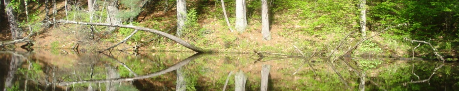
It was a part cloudy evening and the moon did not show up for our paddle.  At 73 degrees and no wind the water looks like glass just before we paddled thought it.  We paddled around the lake 3 times and then when back to shore.  I would like to thank every one who showed up to make this a fun time and we will do another paddle like this at the next full moon.

moonbowl

Here is who is in the picture in order Mike, Carol, Kyle, Marie, Jeff

Trip Report on Rock River 11-19-2006

Trip Report

By Jeff Reuter


This trip report was from Sunday November 19, 2006.  The place was the Rock River from Macktown forests preserve in Rockton, IL to all must Lathem road in Machesney Park, IL.   The temp was about 40 degrees and the winds where out of the north-west at about 10 to 20 MPH.  The wind was not too bad because a lot of the river had high banks on the west side to block some of the wind.  I would like to paddle this section again in the summer some time.  Here is a map of where we when:


Start time: 11/19/2006 12:53:31 PM

Elapsed Time: 02:27:35

Length: 11.0 mi

Average Speed: 4.5 mph

Rock River Paddle 10-20-2007

s_my boat

There will be a paddle Saturday October 20, 2007 from Rockford to Byron on the Rock River.  At this time it looks like there will only be a high 69° and breezy.  Please dress right for this paddle.  We will meet at Paddle and Trail parking lot at 12:00 noon to find out where the put in and take outs will be.  I am being told this would be about a 2.5 hour paddle.  The river is quite shallow in this area so there will be very little power boat traffic.  See are WEB site for more details and up to date information.


More information about the paddle:

Put in will be at Blackhawk Park, Rockford, IL at the boat ramp.  This park is next to the Marinelli Stadium, Rockford, IL or on the east side of the Rock River where 15th Avenue crosses it.  The coordinates to the boat ramp are latitude 42.247174° by longitude -89.103714°.  The tack out will be a small rest area one half mile south of Meridian road on Illinois route 2.  The coordinates to the take out are latitude 42.180237° by longitude -89.181390°.  The trip on the river will be about 8.11 miles long.  The current gage on the Rock River at Byron, IL is at 7.25” and running at 7390 cubic feet per second.  This normally this would be running at 4960 cubic feet per second.

Rock River Voyageur paddle 09-12-2010

Trip Report

Date:  09-12-2010           Leader: Walter Loos                                                        Co-Leader:  Jeff Reuter and Stacey Loos

Body of Water:   Rock River                                      From:    Beloit, WI                                                               To:  Macktown

Gage Station: USGS 05437500 ROCK RIVER AT ROCKTON, IL    Gage Height: 5.12      Discharge:  5870

Outdoor Temp:     84          Cloud Cover:  Sunny

Number of Kayaks: 18           Number of Canoes: 6            Total Boats:  24


I this paddle we had to portage around the Rockton Dam.  To go around the dam we when to the right side of the dam where there was a path.  The path was about 100″ to get back into the water.  After getting back in the water you have to paddle out to the middle of the dam and then straight thought.  Do not take the first pass thought because it is blocked by a tree.  After doing a portage and also with a Voyageur 22″ canoe no one fell in.  Grate paddle and a grate day to do it.  You can see where we went  below and with these tracks.

rock_river_voyageur_20100912

Rock River Paddle 09-11-2010

Trip Report

Date:                   9-11-2010                                             Leader:    Jeff Reuter                                                             Co-Leader:

Body of Water:   Rock River                                           From:  Macktown                                                                 To:  Atwood

Gage Height:     5.31″                                                     Discharge:   6230

Outdoor Temp:   55            Cloud Cover:   Cloudly with some rain

Number of Kayaks:     5      Number of Canuce:      0       Total Boats:  5


Name                                                                    Start Time                             Elapsed Time              Length             Average Speed Link
rockriver_20100911_macktown2atwood      9/11/2010 9:59:04 AM         2:48:25                          9.8 mi               4 mph

 It started as a mistly day but in the end the sunday did come out at about 12:00 pm.  Is was grate paddle even thought it started wet.  Here is the map of where we where:

rockriver_20100911

Trip Report from the Rock River (09-14-2008)

Trip Report

Date: 09-14-2008                                     Leader: Jeff Reuter                      Co-Leader:

Body of Water: Rock River               From: Macktown Park        To: Atwood Homestead

Gage Height: 5.5 Ft.                                       Discharge: 6500 CFPS

Outdoor Temp: 63              Cloud Cover: Must Cloud with Rain

Number of Kayaks: 7          Number of Canoes: 0            Total Boats: 7

Jeff, Bill, Kathy, Wayne, Ellie, Bob, and Jean20080914_rockriver

Trip Report from the Kishwaukee (08-31-2008)

statelinelogo5long

Trip Report

Date: 08-31-2008                                     Leader: Jeff Reuter                      Co-Leader:

Body of Water: Kishwaukee River               From: Baumann Park        To: Seth Atwood Forest Preserve

Gage Height: 5.62 Ft.                                       Discharge: 280 CFPS

Outdoor Temp: 86              Cloud Cover: Mustly Sunny

Number of Kayaks: 4          Number of Canoes: 0            Total Boats: 4

Horicon Marsh (9/28/08)

Date: 08-31-2008 Leader: Jean Burleson                                 Co-Leader: Bob Hollander

Body of Water: Horicon Marsh

From: Green head landing To: Legion Park    Distance: 7.5 miles   Avg. water depth 4.5 feet.

Outdoor Temp: 65        Cloud Cover: Cloudy

Number of kayaks: 7      Number of Canoes: 1  Total Boats: 8

Paddlers: Jean, Bob, Kathy, Wayne, Al, Bill, Ellie, Carol

Put in at Green Head landing and had a fairly easy 7.5 mile paddle through the marsh to Legion Park in Horicon. We followed the poorly marked Horicon Marsh Canoe Trail and a series of markers Bob had left the week before to Horicon and down river to Legion Park.

The day was cool, partly cloudy with a slight breeze. Most of the trip was through a cat tail marsh with a short paddle on the Rock River at the beginning and end. We saw several species of birds including several large formations of geese, but there were no hunters. Fall colors were beginning to appear. The paddle took about 4 hours.

Greenhead landing is about 1.5 hours from Janesville, WI.OLYMPUS DIGITAL CAMERA OLYMPUS DIGITAL CAMERA OLYMPUS DIGITAL CAMERA OLYMPUS DIGITAL CAMERA OLYMPUS DIGITAL CAMERA OLYMPUS DIGITAL CAMERA

Lake Koshkonong Breakfast Paddle 2008

Date: Oct 19, 2008               Leader:  Jean Burleson               Co-Leader: Bob Hollander

Body of Water:  Lake Koskonong/Rock River              From:  Royce Dahlman Cty Park                    To: Newville DNR Boat Landing                                  Outdoor Temp:  50’s             Cloud Cover:   Sunny becoming partly cloudy

Number of Kayaks:    9       Number of Canoes:          1   Total Boats 10

Paddlers: Bob H., Jean B., Bill D., Bill H., Jeff R., Carol M., Carol L, Kathy and Wayne S., Ed G. (Ellie S. joined us for breakfast)

We left Dahlman at around 9:30 and paddled about 2 miles down the lake. The day started sunny with a light breeze (5- 10 mph) and a chill in the air. The paddle went well with almost no powerboat traffic and the paddle craft armada stopped for breakfast at Fin’s Restaurant, just beyond the highway 59 bridge. After an hour or so of talking smart  and eating black bean bread, we got back in our boats and paddled about 2 more miles down the Rock River. While we were eating the wind came up (about 15-20 mph) and created some interesting waves on the last part of the river. While the headwind and waves made the paddling a bit harder, everyone handled it just fine and Bill  and Bob even spent some time playing on the waves while the shuttle was taking place. We were loaded and left by about 2 and most got home in time to see the Packers beat Indianapolis.20081019 Lake Koshkonong paddleDSC03947 DSC03949 DSC03951 DSC03953 DSC03962 DSC03963 DSC03965 DSC03967 DSC03968 DSC03969

Pierce Lake – first of the season 2009

OLYMPUS DIGITAL CAMERADate: March 22, 2009                  Leader: No leader, just a casual  informal paddle
Body of Water: Pierce Lake Rock Cut State Park
Sunny, light winds. Air temp about 65 degrees while the water temp. was a tepid 38 degrees.
Present: Bob H., Jean B., Jeff R., Bill D., Ellie S., Kathy S., Wayne. S.

While this was not an organized trip, I thought I would put it in just to let people know we are on the water again. It all started when I brought the skin on frame boat built in the Paddle and Trail class for the other class members to paddle. I had won the boat in a among the class members, and taken it home and finished it off. We then started talking of paddling on Sun. and told all we saw to join us. Kathy brought some Bavarian cream filled dough nuts which I believe were home made. We paddled around the lake a couple of times and saw migrating loons, several types of ducks, herons, and the rarely sighted Canada goose. I was a very pleasant paddle and a great starter for the season. Bill and Jeff even managed to chase down and haul in a large motor boat which drifted off after the owner neglected to tie it to the dock.